Fayl:Daito-shoto.png
Daha yüksək versiyası yoxdur.
Daito-shoto.png (489 × 507 piksel, fayl həcmi: 543 KB, MIME növü: image/png)
| Bu fayl "Vikimedia Commons"dadır və digər layihələrdə istifadə edilə bilər. |
 |
Faylın təsvir səhifəsinə get |
Xülasə
| İzah |
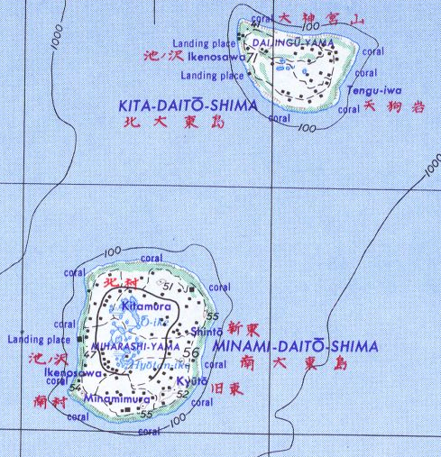
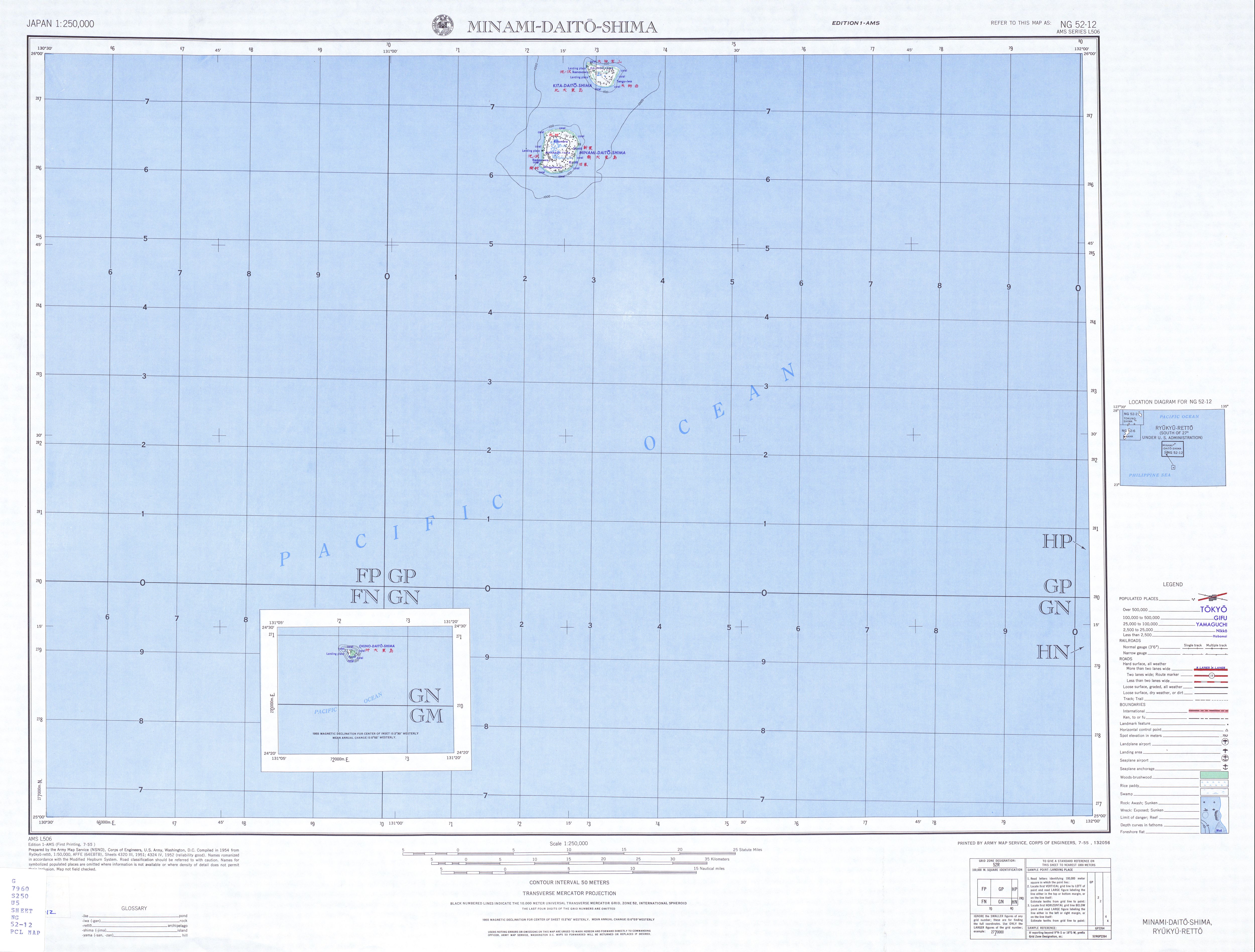
English: Map of Daito-shoto, created by the U.S. Army Map Service. 日本語: 旧米国陸軍地図局が作成した、大東諸島の地図。 |
| Tarix | |
| Mənbə | NG 52-12 (File:Txu-oclc-6900707-ng52-12.jpg), Japan 1:250,000 Series L506, U.S. Army Map Service, 1954- |
| Müəllif | U.S. Army Map Service |
Lisenziya
This work is in the public domain in the United States because it is a work prepared by an officer or employee of the United States Government as part of that person’s official duties under the terms of Title 17, Chapter 1, Section 105 of the US Code.
Note: This only applies to original works of the Federal Government and not to the work of any individual U.S. state, territory, commonwealth, county, municipality, or any other subdivision. This template also does not apply to postage stamp designs published by the United States Postal Service since 1978. (See § 313.6(C)(1) of Compendium of U.S. Copyright Office Practices). It also does not apply to certain US coins; see The US Mint Terms of Use.
|
 | |
| This file has been identified as being free of known restrictions under copyright law, including all related and neighboring rights. | ||
Faylın tarixçəsi
Faylın əvvəlki versiyasını görmək üçün gün/tarix bölməsindəki tarixlərə klikləyin.
| Tarix/Vaxt | Kiçik şəkil | Ölçülər | İstifadəçi | Şərh | |
|---|---|---|---|---|---|
| indiki | 17:24, 19 oktyabr 2006 | | 489 × 507 (543 KB) | Aotearoa | Map of Daito-shoto |
Fayl keçidləri
Aşağıdakı 2 səhifə bu faylı istifadə edir:
Faylın qlobal istifadəsi
Bu fayl aşağıdakı vikilərdə istifadə olunur:
- cs.wikipedia.org layihəsində istifadəsi
- de.wikipedia.org layihəsində istifadəsi
- en.wikipedia.org layihəsində istifadəsi
- ru.wikipedia.org layihəsində istifadəsi
- sv.wikipedia.org layihəsində istifadəsi
- uk.wikipedia.org layihəsində istifadəsi
- uz.wikipedia.org layihəsində istifadəsi