Fayl:Map-Latin America2.png
Daha yüksək versiyası yoxdur.
Map-Latin_America2.png (390 × 450 piksel, fayl həcmi: 22 KB, MIME növü: image/png)
| Bu fayl "Vikimedia Commons"dadır və digər layihələrdə istifadə edilə bilər. |
 |
Faylın təsvir səhifəsinə get |

|
This linguistic map image could be re-created using vector graphics as an SVG file. This has several advantages; see Commons:Media for cleanup for more information. If an SVG form of this image is available, please upload it and afterwards replace this template with
{{vector version available|new image name}}.
It is recommended to name the SVG file “Map-Latin America2.svg”—then the template Vector version available (or Vva) does not need the new image name parameter. |
Xülasə
Español: Ubicación de América Latina

.
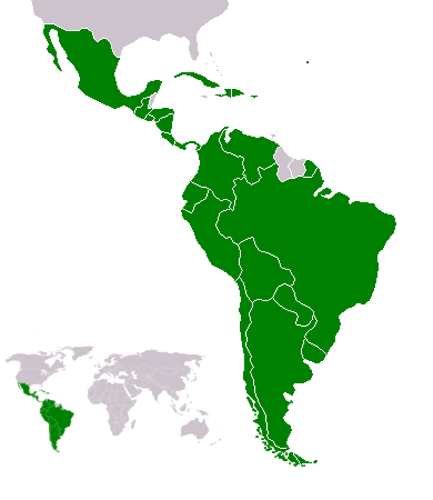
Map of en:Latin america. Thanks to write in the talk page if it's need to improve it. An alternative image is Image:Map-Latin America.png.
Map made from Image:BlankMap-World.png
Lisenziya
Yug, the copyright holder of this work, hereby publishes it under the following license:
| Mən, bu əsərin müəllif hüquqlarının sahibi kimi, əsəri ictimai mülkiyyətə verirəm. Bu icazə bütün dünyada qüvvədədir. In some countries this may not be legally possible; if so: Bunun qanunla mümkün olmadığı hallarda: İstənilən şəxsə, istənilən məqsəd üçün, qanunlar tərəfindən qadağan edilməyincə, heç bir şərt qoymadan bu işdən istifadə haqqını bağışlayıram. |
Atlas
This map should be added to the Wikimedia Atlas.
derivative works
Derivative works of this file: Map-Latin America2-2.png
Faylın tarixçəsi
Faylın əvvəlki versiyasını görmək üçün gün/tarix bölməsindəki tarixlərə klikləyin.
| Tarix/Vaxt | Kiçik şəkil | Ölçülər | İstifadəçi | Şərh | |
|---|---|---|---|---|---|
| indiki | 22:23, 18 fevral 2018 | | 390 × 450 (22 KB) | Andrew J.Kurbiko | minor fix |
| 16:14, 20 mart 2011 |  | 390 × 450 (25 KB) | Philip Stevens | The Falkland Islands are not part of Latin America. | |
| 11:47, 7 dekabr 2008 |  | 390 × 450 (23 KB) | Osado | {{Information |Description= |Source= |Date= |Author= |Permission= |other_versions= }} | |
| 07:07, 20 oktyabr 2008 |  | 390 × 450 (21 KB) | Pruxo | malvinas part of latinoamerica | |
| 16:02, 15 oktyabr 2008 |  | 390 × 450 (21 KB) | Pruxo | mejora de "Imagen:Map-Latin America2.png", agregando islas en chile, agregando las Islas malvinas (o falklands) con color neutral, pasando la Guayana francesa junto con las demas guayanas (es territorio de ultramar frances, si fuera latinoamerica, quevec | |
| 21:55, 25 fevral 2006 |  | 390 × 450 (22 KB) | NoIdeaNick~commonswiki | Changed map to reflect the fact that Jamaica is not part of Latin America. | |
| 14:36, 19 yanvar 2006 |  | 390 × 450 (23 KB) | NoIdeaNick~commonswiki | Just a little change to the color of Belize. | |
| 23:29, 21 dekabr 2005 |  | 390 × 450 (20 KB) | Yug | Zoom |
Fayl keçidləri
Aşağıdakı səhifə bu faylı istifadə edir:
Faylın qlobal istifadəsi
Bu fayl aşağıdakı vikilərdə istifadə olunur:
- af.wikipedia.org layihəsində istifadəsi
- arc.wikipedia.org layihəsində istifadəsi
- azb.wikipedia.org layihəsində istifadəsi
- br.wikipedia.org layihəsində istifadəsi
- br.wiktionary.org layihəsində istifadəsi
- ckb.wikipedia.org layihəsində istifadəsi
- cv.wikipedia.org layihəsində istifadəsi
- cy.wikipedia.org layihəsində istifadəsi
- da.wikipedia.org layihəsində istifadəsi
- de.wikipedia.org layihəsində istifadəsi
- de.wiktionary.org layihəsində istifadəsi
- en.wikipedia.org layihəsində istifadəsi
- Latin America
- User:Dimadick
- Afro–Latin Americans
- User:Nivenus
- Wikipedia:Featured content/Portals
- User:Mikhajist
- User:Zdunne
- User:CatatonicStupor
- Wikipedia:Association of Hispanic and Latin American writers
- User:J. Finkelstein/Sandbox/LatinAmericaInfobox
- User:Es-arturus
- Etiquette in Latin America
- Water supply and sanitation in Latin America
- User:Adam sk
- Wikipedia:Articles for deletion/Log/2007 February 10
- Wikipedia:Articles for deletion/Latino Muslims
- Talk:Latin America/Archive 1
- User:Mvblair
- User:Tcd88
- User:Mikhajist/Userboxes
- User:Zero Gravity/Proposal
- User:Andreasmperu
- Wikipedia:Graphics Lab/Image workshop/Archive/May 2009
- User:Mosemamenti
- User:Mvblair/Userboxes/Latin American History
- User:Richie Boy 5
- User:Mosemamenti/Usuario:Mosemamenti
- User:Fcassia
- User:Samwb123/fp
- User:Saukkomies/My userboxes
- User:IANVS
- User:AKABumba
- User:Daguerrero
- User:Clarkp/Userboxes
- User:Hpav7
- User:Evanex
- User:Ixnix
Bu faylın qlobal istifadəsinə baxın.