Fayl:Map of the Federated States of Micronesia CIA.jpg

Sınaq göstərişi ölçüsü: 740 × 599 piksel. Digər ölçülər: 296 × 240 piksel | 593 × 480 piksel | 948 × 768 piksel | 1.200 × 972 piksel.
Faylın orijinalı (1.200 × 972 piksel, fayl həcmi: 312 KB, MIME növü: image/jpeg)
| Bu fayl "Vikimedia Commons"dadır və digər layihələrdə istifadə edilə bilər. |
 |
Faylın təsvir səhifəsinə get |
Xülasə
| İzah |
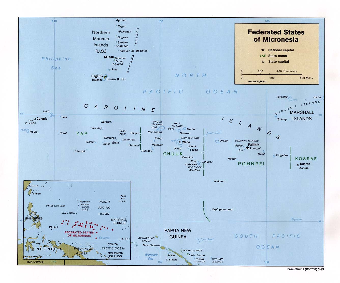
English: Map of the Federated States of Micronesia — in the Micronesia regon. |
| Tarix | |
| Mənbə | Federated States of Micronesia (Political) 1999 from Perry-Castañeda Library Map Collection: Federated States of Micronesia Maps |
| Müəllif | U.S. Central Intelligence Agency |
| İcazə (Faylın təkrar istifadəsi) |
Public domain |
Lisenziya
| This image is a work of a Central Intelligence Agency employee, taken or made as part of that person's official duties. As a Work of the United States Government, this image or media is in the public domain in the United States.
|

|
Faylın tarixçəsi
Faylın əvvəlki versiyasını görmək üçün gün/tarix bölməsindəki tarixlərə klikləyin.
| Tarix/Vaxt | Kiçik şəkil | Ölçülər | İstifadəçi | Şərh | |
|---|---|---|---|---|---|
| indiki | 15:57, 17 sentyabr 2010 | | 1.200 × 972 (312 KB) | Ras67 | rotated 0.22 degree ccw, cropped |
| 09:09, 22 yanvar 2005 |  | 1.336 × 1.114 (140 KB) | Hoshie | CIA map of FSM. {{PD-PCL|http://www.lib.utexas.edu/maps/islands_oceans_poles/micronesia_pol99.jpg}} |
Fayl keçidləri
Aşağıdakı səhifə bu faylı istifadə edir:
Faylın qlobal istifadəsi
Bu fayl aşağıdakı vikilərdə istifadə olunur:
- af.wikipedia.org layihəsində istifadəsi
- ami.wikipedia.org layihəsində istifadəsi
- an.wikipedia.org layihəsində istifadəsi
- ar.wikipedia.org layihəsində istifadəsi
- ary.wikipedia.org layihəsində istifadəsi
- avk.wikipedia.org layihəsində istifadəsi
- bg.wikipedia.org layihəsində istifadəsi
- bn.wikipedia.org layihəsində istifadəsi
- ca.wikipedia.org layihəsində istifadəsi
- cs.wikipedia.org layihəsində istifadəsi
- cv.wikipedia.org layihəsində istifadəsi
- da.wikipedia.org layihəsində istifadəsi
- de.wikipedia.org layihəsində istifadəsi
- el.wikipedia.org layihəsində istifadəsi
- en.wikipedia.org layihəsində istifadəsi
- Federated States of Micronesia
- History of the Federated States of Micronesia
- Geography of the Federated States of Micronesia
- Ecclesiastical provinces and dioceses of the Episcopal Church
- User:Jonny-mt/Gallery of current first-level administrative country subdivisions maps
- Outline of the Federated States of Micronesia
- Index of Federated States of Micronesia–related articles
- Isokelekel
- List of islands of the Federated States of Micronesia
- Naval Base Ulithi
- US Naval Base Carolines
- 2023 Micronesian constitutional referendum
- eo.wikipedia.org layihəsində istifadəsi
- es.wikipedia.org layihəsində istifadəsi
- eu.wikipedia.org layihəsində istifadəsi
- fa.wikipedia.org layihəsində istifadəsi
- fi.wikipedia.org layihəsində istifadəsi
- fr.wikipedia.org layihəsində istifadəsi
- fr.wiktionary.org layihəsində istifadəsi
Bu faylın qlobal istifadəsinə baxın.