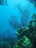
Fayl:Reef 247.jpg

Sınaq göstərişi ölçüsü: 450 × 600 piksel. Digər ölçülər: 180 × 240 piksel | 360 × 480 piksel | 576 × 768 piksel | 768 × 1.024 piksel | 2.112 × 2.816 piksel.
Faylın orijinalı (2.112 × 2.816 piksel, fayl həcmi: 1,69 MB, MIME növü: image/jpeg)
Faylın tarixçəsi
Faylın əvvəlki versiyasını görmək üçün gün/tarix bölməsindəki tarixlərə klikləyin.
| Tarix/Vaxt | Kiçik şəkil | Ölçülər | İstifadəçi | Şərh | |
|---|---|---|---|---|---|
| indiki | 07:48, 1 aprel 2009 |  | 2.112 × 2.816 (1,69 MB) | Monfornot | Rotated |
| 07:46, 1 aprel 2009 |  | 2.816 × 2.112 (1,53 MB) | Monfornot | {{Information |Description= Photo by Lauretta Burke, World Resources Institute, 2007. Taken in the Soufriere area of St. Lucia. The Economic Valuation of Coral Reefs project aims to use valuation estimates to improve the management of coral reef ecosyst |
Fayl keçidləri
Aşağıdakı səhifə bu faylı istifadə edir:
Faylın qlobal istifadəsi
Bu fayl aşağıdakı vikilərdə istifadə olunur:
- ar.wikipedia.org layihəsində istifadəsi
- cy.wikipedia.org layihəsində istifadəsi
- en.wikipedia.org layihəsində istifadəsi
- es.wikipedia.org layihəsində istifadəsi
- eu.wikipedia.org layihəsində istifadəsi
- glk.wikipedia.org layihəsində istifadəsi
- hy.wikipedia.org layihəsində istifadəsi
- incubator.wikimedia.org layihəsində istifadəsi
- it.wikipedia.org layihəsində istifadəsi
- nl.wiktionary.org layihəsində istifadəsi
- qu.wikipedia.org layihəsində istifadəsi
- ru.wikipedia.org layihəsində istifadəsi
- tr.wikipedia.org layihəsində istifadəsi
- udm.wikipedia.org layihəsində istifadəsi
- zh-yue.wikipedia.org layihəsində istifadəsi
- zh.wikipedia.org layihəsində istifadəsi
