Fayl:Satellite image of Hokkaido, Japan in January 2003.jpg

Sınaq göstərişi ölçüsü: 471 × 599 piksel. Digər ölçülər: 188 × 240 piksel | 377 × 480 piksel | 603 × 768 piksel | 804 × 1.024 piksel | 2.200 × 2.800 piksel.
Faylın orijinalı (2.200 × 2.800 piksel, fayl həcmi: 1,74 MB, MIME növü: image/jpeg)
| Bu fayl "Vikimedia Commons"dadır və digər layihələrdə istifadə edilə bilər. |
 |
Faylın təsvir səhifəsinə get |
Xülasə
Xülasə
| İzah |
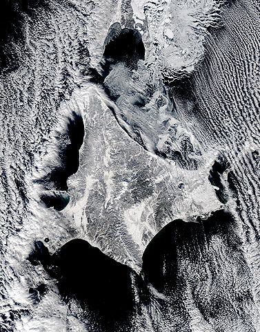
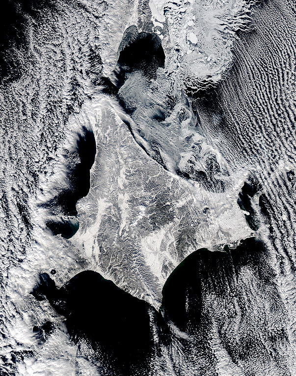
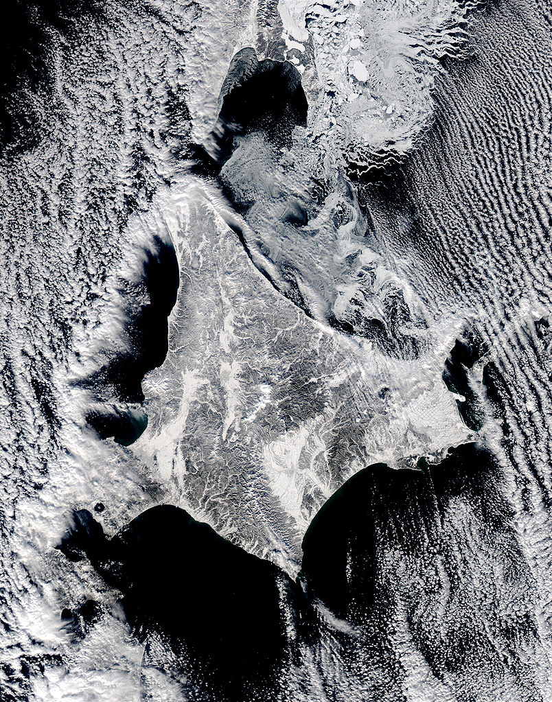
English: Satellite image of Hokkaido, Japan in January 2003. This stunning true-color image shows clouds surrounding northern Japan’s snow-dusted Hokkaido Island in between the black waters of two seas and an ocean. Hokkaido Island is home to the city of Sapporo, which is located on the lower western side near where the island’s tail begins to curve south toward the main island of Japan (middle lower left) and not far from the Ishikari-wan, the north-facing bay that has a streak of clouds moving horizontally across it. Hokkaido’s northern point reaches toward the Russian island of Sakhalin (top center), while the eastern point stretches toward the Kuril Islands, a volcanic chain that eventually connects to the Russian Kamchatka Peninsula. Between Hokkaido’s northern and eastern points lies the southern reaches of the Sea of Okhotsk (upper right), while the northern and southern points lie along the Sea of Japan. From its southern to eastern point, the Pacific Ocean laps at Hokkaido’s shores. This Aqua MODIS image was acquired January 15, 2003. |
| Tarix | |
| Mənbə | NASA's Visible Earth http://visibleearth.nasa.gov/view_rec.php?id=4720 |
| Müəllif | NASA's Visible Earth |
Lisenziya
| This file is in the public domain in the United States because it was solely created by NASA. NASA copyright policy states that "NASA material is not protected by copyright unless noted". (See Template:PD-USGov, NASA copyright policy page or JPL Image Use Policy.) | ||
 |
Warnings:
|
Faylın tarixçəsi
Faylın əvvəlki versiyasını görmək üçün gün/tarix bölməsindəki tarixlərə klikləyin.
| Tarix/Vaxt | Kiçik şəkil | Ölçülər | İstifadəçi | Şərh | |
|---|---|---|---|---|---|
| indiki | 22:02, 7 may 2006 | | 2.200 × 2.800 (1,74 MB) | Akanemoto~commonswiki | Satellite image of Hokkaido, Japan in January 2003. Taken from NASA's Visible Earth http://visibleearth.nasa.gov/view_rec.php?id=4720 : This stunning true-color image shows clouds surrounding northern Japan’s snow-dusted Hokkaido Island in between the |
Fayl keçidləri
Aşağıdakı səhifə bu faylı istifadə edir:
Faylın qlobal istifadəsi
Bu fayl aşağıdakı vikilərdə istifadə olunur:
- ast.wikipedia.org layihəsində istifadəsi
- ba.wikipedia.org layihəsində istifadəsi
- en.wikipedia.org layihəsində istifadəsi
- es.wikipedia.org layihəsində istifadəsi
- id.wikipedia.org layihəsində istifadəsi
- it.wikipedia.org layihəsində istifadəsi
- ja.wikipedia.org layihəsində istifadəsi
- km.wikipedia.org layihəsində istifadəsi
- pam.wikipedia.org layihəsində istifadəsi
- pt.wikipedia.org layihəsində istifadəsi
- ru.wikinews.org layihəsində istifadəsi
- tg.wikipedia.org layihəsində istifadəsi
- vi.wikipedia.org layihəsində istifadəsi