Fayl:Tanegashima txu-oclc-6900707-nh52-8.jpg

Sınaq göstərişi ölçüsü: 279 × 600 piksel. Digər ölçülər: 111 × 240 piksel | 223 × 480 piksel | 805 × 1.730 piksel.
Faylın orijinalı (805 × 1.730 piksel, fayl həcmi: 447 KB, MIME növü: image/jpeg)
| Bu fayl "Vikimedia Commons"dadır və digər layihələrdə istifadə edilə bilər. |
 |
Faylın təsvir səhifəsinə get |
Xülasə
| İzah |
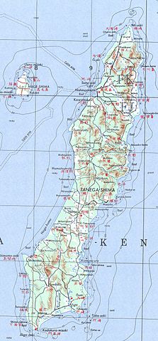
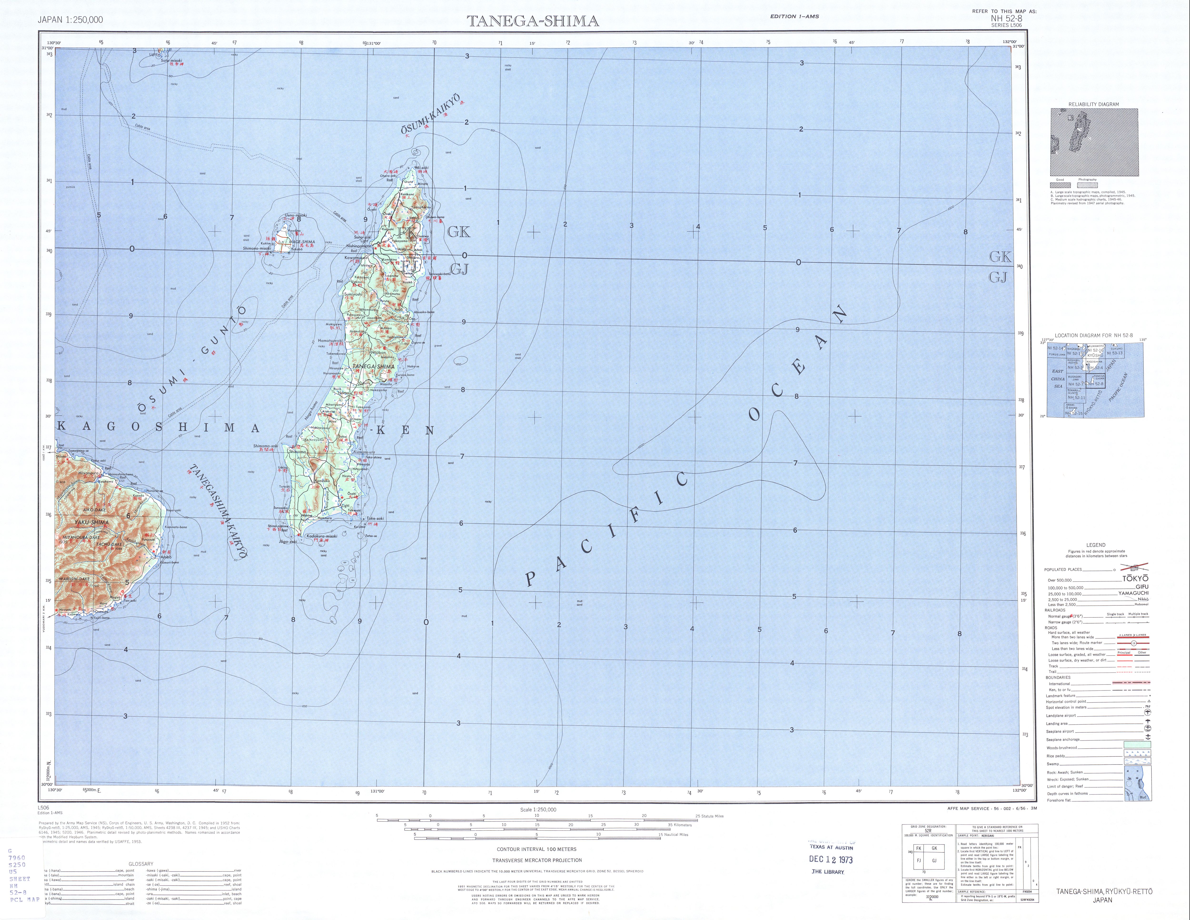
English: map sheet Tanegashima, southern Japan |
| Tarix | |
| Mənbə | http://www.lib.utexas.edu/maps/ams/japan/txu-oclc-6900707-nh52-8.jpg |
| Müəllif | Army Map Service, Corps of Engineers |
Lisenziya
This file is a work of a U.S. Army soldier or employee, taken or made as part of that person's official duties. As a work of the U.S. federal government, it is in the public domain in the United States.
|
 |
Faylın tarixçəsi
Faylın əvvəlki versiyasını görmək üçün gün/tarix bölməsindəki tarixlərə klikləyin.
| Tarix/Vaxt | Kiçik şəkil | Ölçülər | İstifadəçi | Şərh | |
|---|---|---|---|---|---|
| indiki | 17:52, 20 noyabr 2012 | | 805 × 1.730 (447 KB) | Mps2 | Tanegashima extracted |
| 17:14, 11 dekabr 2010 |  | 5.000 × 3.864 (3,66 MB) | Ratzer | {{Information |Description={{en|1=map sheet Tanegashima, southern Japan}} |Source=http://www.lib.utexas.edu/maps/ams/japan/txu-oclc-6900707-nh52-8.jpg |Author=Army Map Service, Corps of Engineers |Date=1952 |Permission= |other_versions= }} [[Category:Map |
Fayl keçidləri
Aşağıdakı səhifə bu faylı istifadə edir:
Faylın qlobal istifadəsi
Bu fayl aşağıdakı vikilərdə istifadə olunur:
- de.wikipedia.org layihəsində istifadəsi
- es.wikipedia.org layihəsində istifadəsi
- no.wikipedia.org layihəsində istifadəsi
- pt.wikipedia.org layihəsində istifadəsi
- ru.wikipedia.org layihəsində istifadəsi