Fayl:Kremlenagrad.jpg
Sınaq göstərişi ölçüsü: 782 × 600 piksel. Digər ölçülər: 313 × 240 piksel | 626 × 480 piksel | 1.002 × 768 piksel | 1.280 × 982 piksel | 2.560 × 1.963 piksel | 2.736 × 2.098 piksel.
Faylın orijinalı (2.736 × 2.098 piksel, fayl həcmi: 4,83 MB, MIME növü: image/jpeg)
| Bu fayl "Vikimedia Commons"dadır və digər layihələrdə istifadə edilə bilər. |
 |
Faylın təsvir səhifəsinə get |
Xülasə
| İzah |
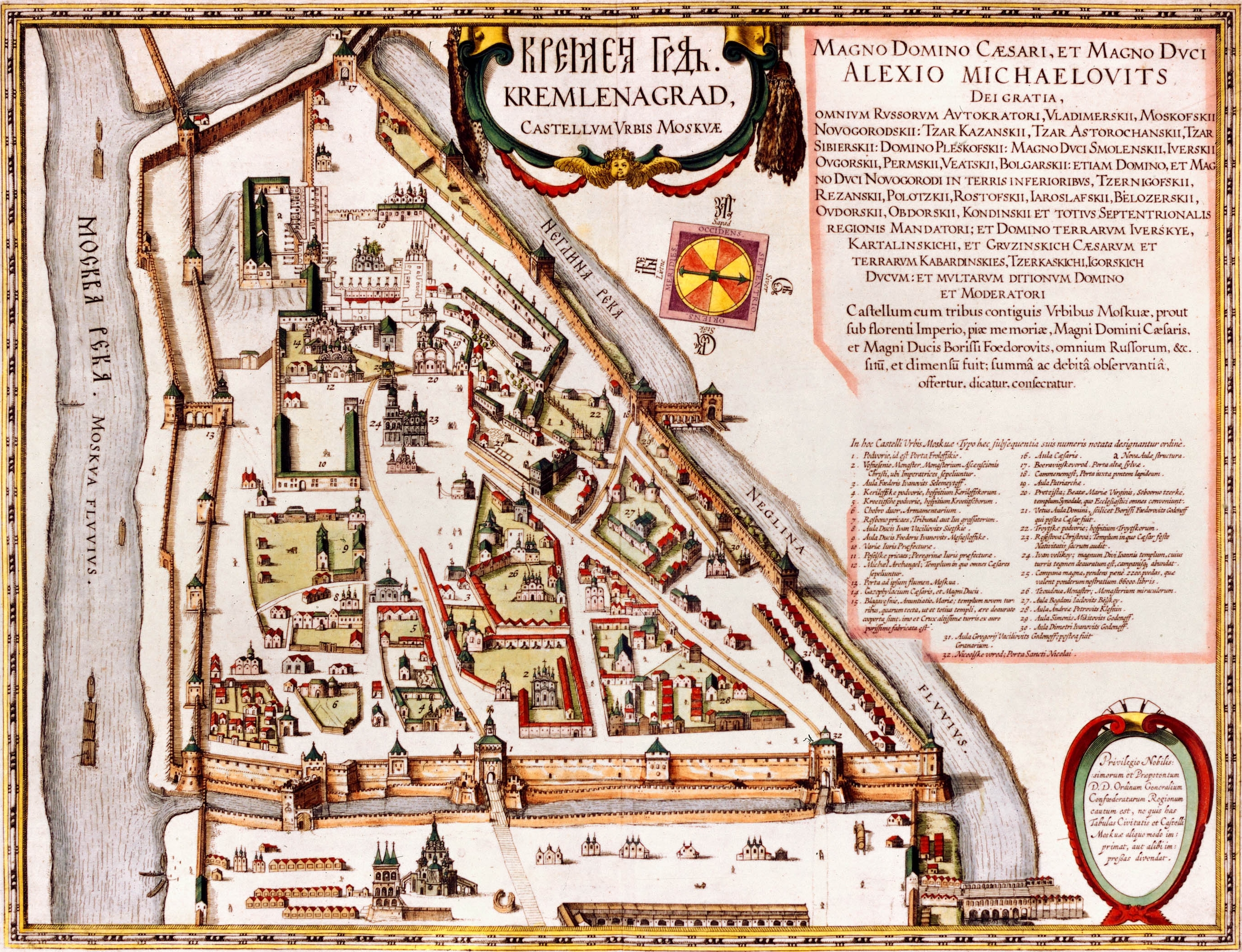
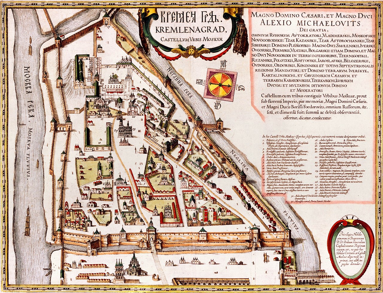
English: Kremlenagrad Castellum Urbis Moskvae: the first detailed map of the Moscow Kremlin, created during the reign of Alexis Mikhailovich Latina: Tabula Castelli Urbi Moskuae (Kremlin); Alexio Michaelo filio rege a Ioanne Blaeuo factus |
| Tarix | |
| Mənbə |
|
| Müəllif | Joan Blaeu |
Lisenziya
|
This work is in the public domain in its country of origin and other countries and areas where the copyright term is the author's life plus 100 years or fewer. This work is in the public domain in the United States because it was published (or registered with the U.S. Copyright Office) before January 1, 1929. | |
| This file has been identified as being free of known restrictions under copyright law, including all related and neighboring rights. | |
| Annotations | This image is annotated: View the annotations at Commons |
Faylın tarixçəsi
Faylın əvvəlki versiyasını görmək üçün gün/tarix bölməsindəki tarixlərə klikləyin.
| Tarix/Vaxt | Kiçik şəkil | Ölçülər | İstifadəçi | Şərh | |
|---|---|---|---|---|---|
| indiki | 05:05, 13 may 2008 | | 2.736 × 2.098 (4,83 MB) | Kimse | Higher resolution from http://historic-cities.huji.ac.il/russia/moscow/maps/blaeu_french_1663_v2.html |
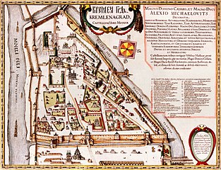
| 10:26, 3 sentyabr 2006 |  | 350 × 307 (25 KB) | Ghirlandajo | "Kremlenagrad": the first detailed map of the Moscow Kremlin, 1601. Source: http://www.kreml.ru/ru/main/history/kremlin/XVI/ Category:Moscow Kremlin Category:History of Moscow |
Fayl keçidləri
Aşağıdakı səhifə bu faylı istifadə edir:
Faylın qlobal istifadəsi
Bu fayl aşağıdakı vikilərdə istifadə olunur:
- af.wikipedia.org layihəsində istifadəsi
- am.wikipedia.org layihəsində istifadəsi
- bs.wikipedia.org layihəsində istifadəsi
- cs.wikipedia.org layihəsində istifadəsi
- da.wikipedia.org layihəsində istifadəsi
- de.wikipedia.org layihəsində istifadəsi
- el.wikipedia.org layihəsində istifadəsi
- en.wikipedia.org layihəsində istifadəsi
- fy.wikipedia.org layihəsində istifadəsi
- gl.wikipedia.org layihəsində istifadəsi
- id.wikipedia.org layihəsində istifadəsi
- ko.wikipedia.org layihəsində istifadəsi
- la.wikipedia.org layihəsində istifadəsi
- lld.wikipedia.org layihəsində istifadəsi
- my.wikipedia.org layihəsində istifadəsi
- pt.wikipedia.org layihəsində istifadəsi
- ru.wikipedia.org layihəsində istifadəsi
- sh.wikipedia.org layihəsində istifadəsi
- sk.wikipedia.org layihəsində istifadəsi
- sl.wikipedia.org layihəsində istifadəsi
- sq.wikipedia.org layihəsində istifadəsi
- sr.wikipedia.org layihəsində istifadəsi
- uk.wikipedia.org layihəsində istifadəsi
- Московський кремль
- Шаблон:Moscow-week-new
- Шаблон:Moscow-week-improve
- Обговорення:Новокур'яново
- Обговорення:Хохловський майдан
- Обговорення:Мавзолей (садиба Суханово)
- Обговорення:Доменіко Жилярді
- Обговорення:Щукін Дмитро Іванович
- Обговорення:Російський музей лісу
- Обговорення:Садиба Братцево
- Обговорення:Музей Ігоря Талькова
- Обговорення:Бахрушин Олексій Олександрович
- Обговорення:Павелецька (станція метро, Кільцева лінія)
- Обговорення:Кремлівська АЗС на Волхонці
- Обговорення:Церква Спаса, садиба Вороново
- Будівля приказів
- Іванівська площа
- ur.wikipedia.org layihəsində istifadəsi