Fayl:Lincoln Sea map-ta.svg

Bu SVG-faylın PNG formatındakı bu görünüşünün ölçüsü: 657 × 600 piksel. Digər ölçülər: 263 × 240 piksel | 526 × 480 piksel | 841 × 768 piksel | 1.122 × 1.024 piksel | 2.243 × 2.048 piksel | 1.000 × 913 piksel.
Faylın orijinalı (SVG faylı, nominal olaraq 1.000 × 913 piksel, faylın ölçüsü: 199 KB)
| Bu fayl Vikianbardandır və digər layihələrdə istifadə edilə bilər. |
 |
Faylın təsvir səhifəsinə get |
Xülasə
| İzah |
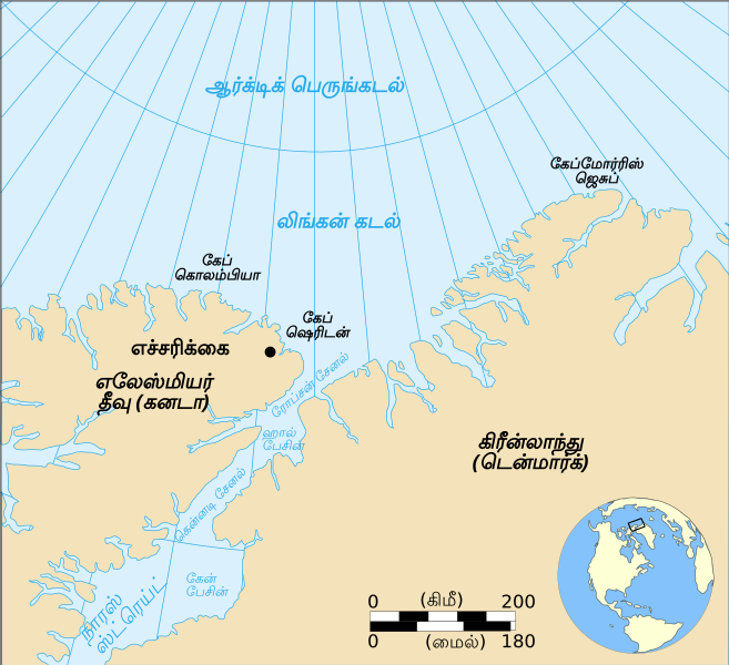
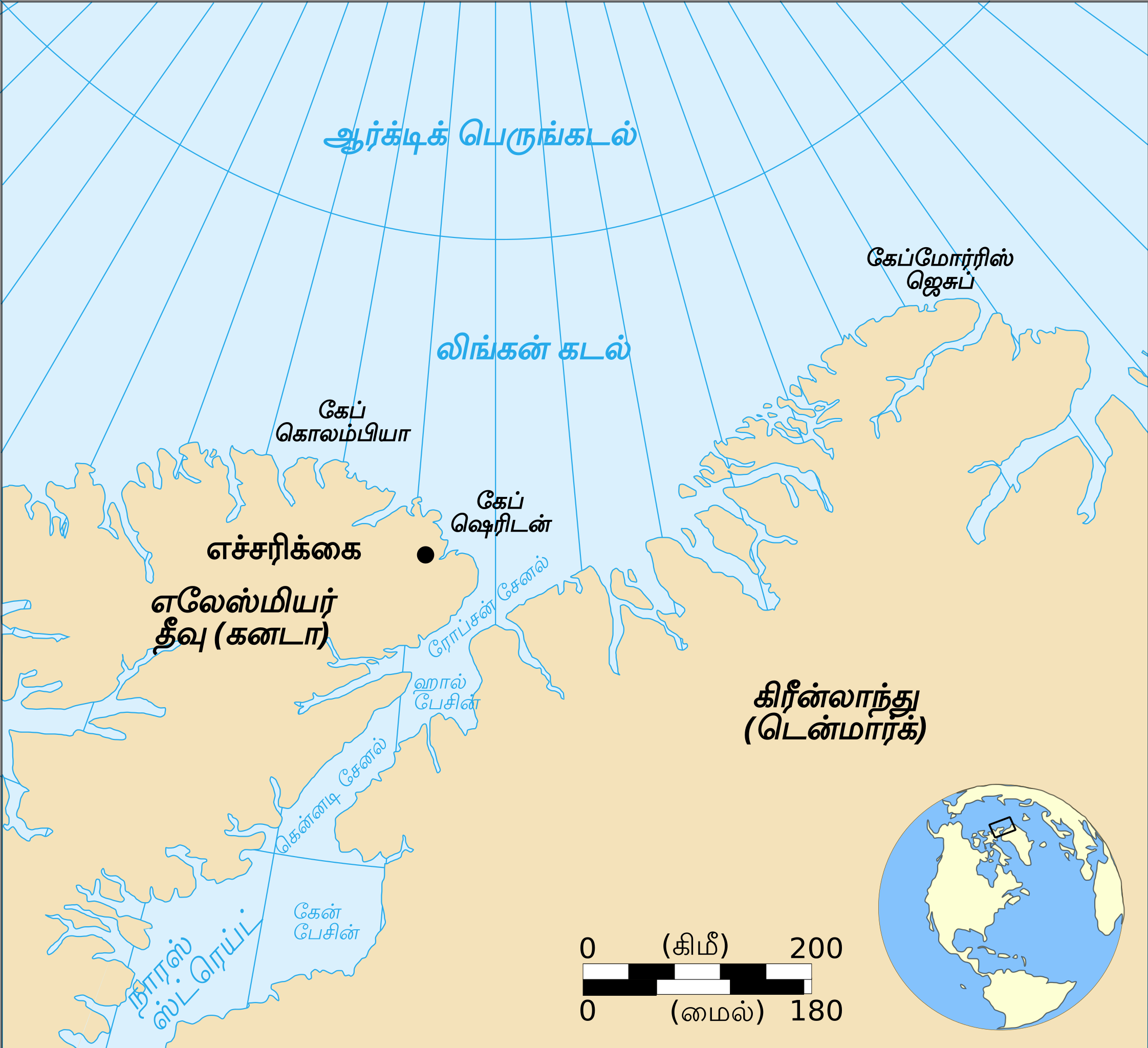
English: Map showing the location of the Lincoln Sea, part of the Arctic Ocean. Also shows Cape Columbia and Cape Morris Jesup: English Version |
| Tarix | |
| Mənbə | travail personnel made with Inkscape from Image:Lincoln Sea map.png by Pinpin |
| Müəllif | Translated into Tamil by User:Mekala Harika |
| Digər versiyalar |
[]
|


Lisenziya
| This file is made available under the Creative Commons CC0 1.0 Universal Public Domain Dedication. | |
| The person who associated a work with this deed has dedicated the work to the public domain by waiving all of their rights to the work worldwide under copyright law, including all related and neighboring rights, to the extent allowed by law. You can copy, modify, distribute and perform the work, even for commercial purposes, all without asking permission.
|
Faylın tarixçəsi
Faylın əvvəlki versiyasını görmək üçün gün/tarix bölməsindəki tarixlərə klikləyin.
| Tarix/Vaxt | Miniatür | Ölçülər | İstifadəçi | Şərh | |
|---|---|---|---|---|---|
| hal-hazırkı | 09:34, 25 mart 2019 | | 1.000 × 913 (199 KB) | Mekala Harika | User created page with UploadWizard |
Faylın istifadəsi
Bu faylı istifadə edən səhifə yoxdur.